Overview
Mobile
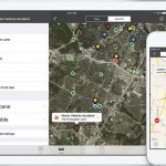
In an emergency, seconds count. GeoSafe Mobile provides easy-to-use GPS tracking and CAD integration for police, fire, and EMS. Quickly access and communicate critical data to units out in the field.
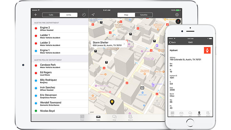
- GPS tracking
Locate all units with live GPS tracking. Color-coded units show who is busy, en route, or available. - CAD integration
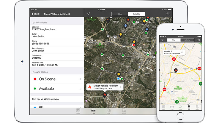
View live updating 911-call information direct from your CAD system. - Interoperability
Seamlessly share data between multiple agencies. - Secure
We encrypt all data and meet all federal security policy requirements
How it works
- Dispatch
Dispatcher enters calls into your CAD as usual - CAD
GeoSafe connects to your agency’s CAD system - Processing
Call data is securely uploaded to the GeoSafe data center - Distribution
Units sign in to Mobile to view CAD data on authorized devices
Details
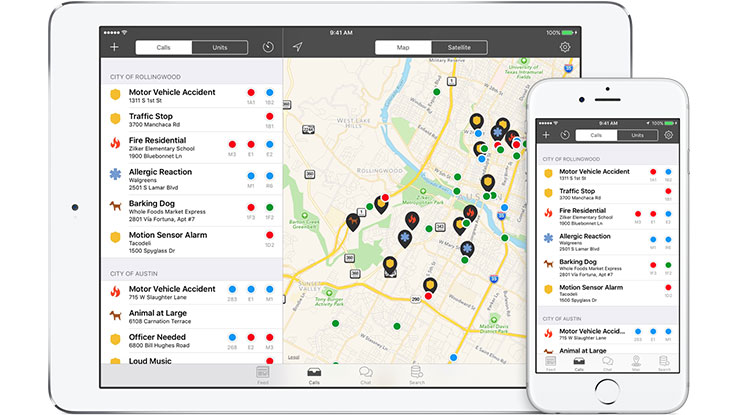
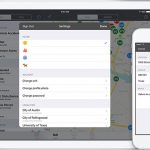
Calls & Units
Increase your fleet's effectiveness with access to GPS (AVL) and live updating 911-call information from the field. From patrol to command centers, simplify your daily activities, large scale events, and incident management.
Interoperability
Reduce response times and improve officer safety by sharing data between different CAD systems. Heighten your situational awareness by seamlessly coordinating multi-agency responses for mutual aid.
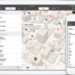
Maps
Empower first-responders with integrated mapping layers including: hydrants, storm shelters, cameras, and pre-incident plans.
Call timestamping
Mark yourself enroute or on scene to a call with a single tap. Your status is automatically updated in CAD.
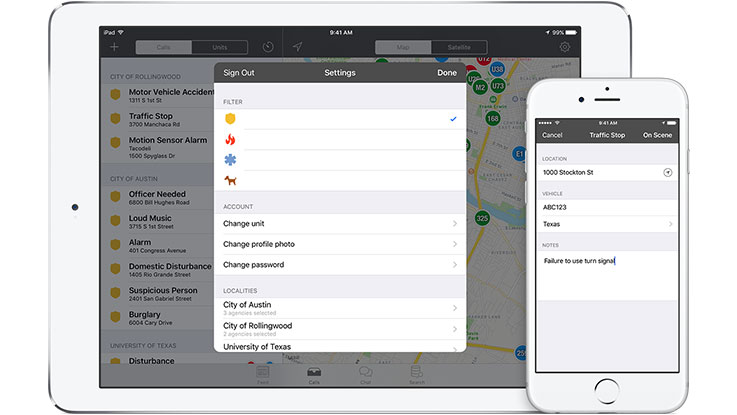
Traffic stops
Create new traffic stops based on your current location without ever using the radio.
Logging
Export GPS activity per user or by region.
SMS notifications
Receive a text message when your unit gets assigned to a call.
Images
Videos

Sorry, you must be logged in to view the rest of this page
Please log in or create an account to view more details.
Log in or Sign UpCustomers and Partners
Sorry, you must be logged in to view the rest of this page
Please log in or create an account to view more details.
Log in or Sign UpDocuments
Sorry, you must be logged in to view the rest of this page
Please log in or create an account to view more details.
Log in or Sign UpExpert Analysis
Sorry, you must be logged in to view the rest of this page
Please log in or create an account to view more details.
Log in or Sign UpExpert Analysis
“I can use GeoSafe to re-dispatch the closest officer”
- Tony Towery , LieutenantMoore Police Department


