Overview
High-resolution, high frequency imagery at down-to-earth prices
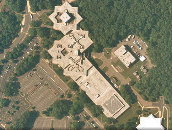
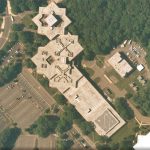
Near Space Labs provides timely, wide-scale, commercially available imagery with the largest zero-emission balloon fleet in the stratosphere.
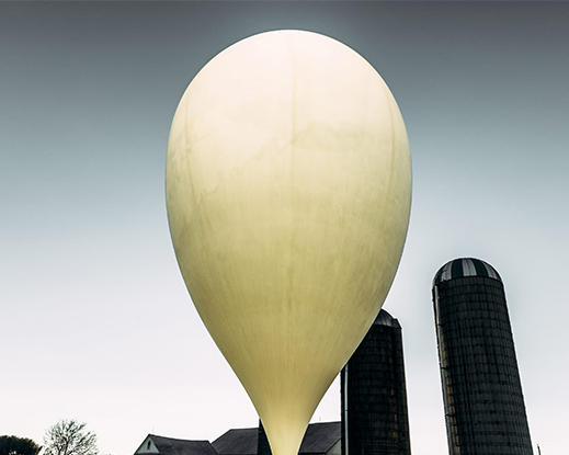
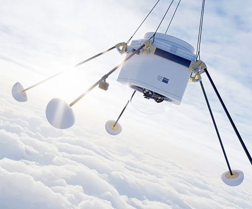
Meet the Swifty
The Swifty is an autonomous high altitude platform, but you can think of it as a sophisticated weather balloon. Swiftys make frequent flights in the stratosphere between 60,000 and 85,000 feet capturing a whopping 400 – 1,000 sq km of imagery per flight. For reference, in one flight we can capture all of New York City’s five boroughs. The stratosphere also gives us a better vantage point for a much lower price than airplanes and satellites. We work around clouds more easily too.
Government
Our scalable imagery is great for state, local, and federal government applications across a variety of departments
- City Planning & Monitoring Land Use
As urban areas develop, government agencies must keep track of land use patterns, population growth, and public infrastructure to ensure the rate of growth is sustainable. Planning failures can lead to damaging, and sometimes irreversible, risks. Spatial monitoring improves decision making to ensure cities are not built in high-hazard zones.
Near Space Labs collects imagery at up to a daily cadence, which boosts city planning initiatives. Our imagery provides a birds-eye view to help city planners make financial decisions. For example, imagery helps assess the value new roads bring to a city or if local wildlife is at risk for causing financial obligations. These datasets are also used to construct the appropriate environmental and urban development policies. - Machine Learning
Large volumes of imagery provide an invaluable foundation for machine learning and AI models. The data can be used for object detection and also to improve roads and traffic, analyze urban landscapes, count vehicles, and build spatial prediction models. Using this type of automation, government employees can streamline their processes and automate change-tracking. - Tax Assessment
Another essential application for high resolution imagery is enabling tax assessors to monitor how land is being used and undergoing change. For example, assessor’s mapping departments can overlay imagery with property outlines to confirm their legal descriptions and note any existing structures.
Near Space Labs’ solution removes the need to monitor properties on foot, and instead provides a remote and holistic view of an entire area. This saves tax assessors thousands of dollars in transportation and payroll costs. In addition properties that are hard-to-reach, due to locked gates or obstructions, are easily accessible with our Swiftys.
Details
High Resolution
Track changes around high-valued assets and spot trends with 22-30 cm imagery. 10 cm resolution coming soon.
High Frequency
Need imagery at scale with more than weekly or monthly updates? We can fly up to five times a day.
Low Cost
Our proprietary platform brings down traditionally sky-high satellite and plane-based imaging costs by 30-45%.
Zero-Emission Technology
Shrink your carbon footprint. Unlike aircraft and satellite solutions, our balloon-based approach is carbon-free.
Images

Videos

Sorry, you must be logged in to view the rest of this page
Please log in or create an account to view more details.
Log in or Sign UpCustomers and Partners
Sorry, you must be logged in to view the rest of this page
Please log in or create an account to view more details.
Log in or Sign UpDocuments
Sorry, you must be logged in to view the rest of this page
Please log in or create an account to view more details.
Log in or Sign UpExpert Analysis
Sorry, you must be logged in to view the rest of this page
Please log in or create an account to view more details.
Log in or Sign Up


